Configure an Infobox for a layer
Last updated
By the end of this guide, you will be able to attach an infobox to a layer so that when a user clicks a feature on that layer, a panel opens showing the feature’s information. This guide assumes you are familiar with adding a layer (see Add a layer).
An infobox is configured as part of the layer itself, using the layer’s
infobox property. You add one or more blocks to the infobox, and Re:Earth
Visualizer displays them whenever a user selects a feature of that layer.
Sample code
Section titled “Sample code”This example adds a single marker with a few properties and attaches an infobox that automatically displays all of the feature’s properties when it is selected.
reearth.yml
id: infobox-demo-pluginname: Infobox Demo Pluginversion: 1.0.0extensions: - id: infobox-demo type: widget name: Infobox Demoinfobox-demo.js
reearth.layers.add({  type: "simple",  data: {    type: "geojson",    value: {      type: "FeatureCollection",      features: [        {          type: "Feature",          properties: {            name: "Tokyo Tower",            height: "333 m",            category: "Landmark",          },          geometry: {            type: "Point",            coordinates: [139.7454, 35.6586],          },        },      ],    },  },  infobox: {    blocks: [      {        pluginId: "reearth",        extensionId: "propertyInfoboxBetaBlock",      },    ],  },  marker: {    style: "point",    pointColor: "#ff0000",    pointSize: 12,  },});
reearth.camera.setView({  lat: 35.6586,  lng: 139.7454,  height: 80000,  heading: 0,  pitch: -1.5708,  roll: 0,});
Result
Section titled “Result”A marker appears on the map at Tokyo Tower. Clicking it opens an infobox listing the feature’s properties—its name, height, and category.
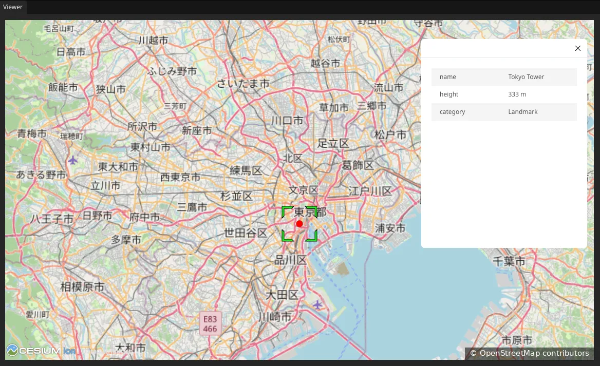
Map data from OpenStreetMap.
How it works
Section titled “How it works”The infobox is configured on the layer itself, through the infobox property
passed to reearth.layers.add:
infobox: { blocks: [ { pluginId: "reearth", extensionId: "propertyInfoboxBetaBlock" } ]}blocks: The list of blocks shown in the infobox, in order.pluginIdandextensionId: Identify which block to display. Here,reearth/propertyInfoboxBetaBlockis a built-in block that automatically lists every property of the selected feature—so you get a full property display without writing any block code yourself.
The properties shown in the infobox come from the feature’s own properties
object in the GeoJSON—here, name, height, and category. Add more
properties there and they appear in the infobox too.
Because the infobox belongs to the layer, it appears only when a user selects a feature of that layer. Nothing shows until a feature is clicked.
What’s next
Section titled “What’s next”- Add a layer: the layer basics this guide builds on
- reearth.layers API reference: the full layer object, including infobox and block options
- Differences between extension types: how the InfoboxBlock extension type relates to what you built here