Rendering Public API items as GeoJSON on a map
Last updated
With Public API, you can retrieve items from a model that has a geometry field as GeoJSON. The GeoJSON you get back can be passed directly to a map library such as MapLibre GL JS or Leaflet, or to Re:Earth Visualizer, for display.
Sample code
Section titled “Sample code”Here’s a sample HTML page that fetches items as GeoJSON from Public API and displays them on a map with MapLibre GL JS. Replace WORKSPACE_ID, PROJECT_ID, and MODEL_ID with your actual values.
<!DOCTYPE html><html><head>  <meta charset="utf-8" />  <title>Re:Earth CMS Public API + MapLibre GL JS</title>  <link href="https://unpkg.com/maplibre-gl/dist/maplibre-gl.css" rel="stylesheet" />  <script src="https://unpkg.com/maplibre-gl/dist/maplibre-gl.js"></script>  <style>    body { margin: 0; }    #map { width: 100%; height: 100vh; }  </style></head><body>  <div id="map"></div>  <script>    const WORKSPACE_ID = "<workspace_id_or_alias>";    const PROJECT_ID = "<project_id_or_alias>";    const MODEL_ID = "<model_id_or_key>";
    const map = new maplibregl.Map({      container: "map",      style: "https://tile.openstreetmap.jp/styles/osm-bright-en/style.json",      center: [139.6917, 35.6895],      zoom: 10,    });
    const CMS_URL = `https://api.cms.reearth.io/api/p/${WORKSPACE_ID}/${PROJECT_ID}/${MODEL_ID}.geojson`;
    map.on("load", async () => {      const resp = await fetch(CMS_URL);      if (!resp.ok) throw new Error(`HTTP ${resp.status}`);      const geojson = await resp.json();
      map.addSource("cms-data", { type: "geojson", data: geojson });      map.addLayer({        id: "cms-layer",        type: "circle",        source: "cms-data",        paint: {          "circle-radius": 8,          "circle-color": "#e63946",        },      });    });  </script></body></html>
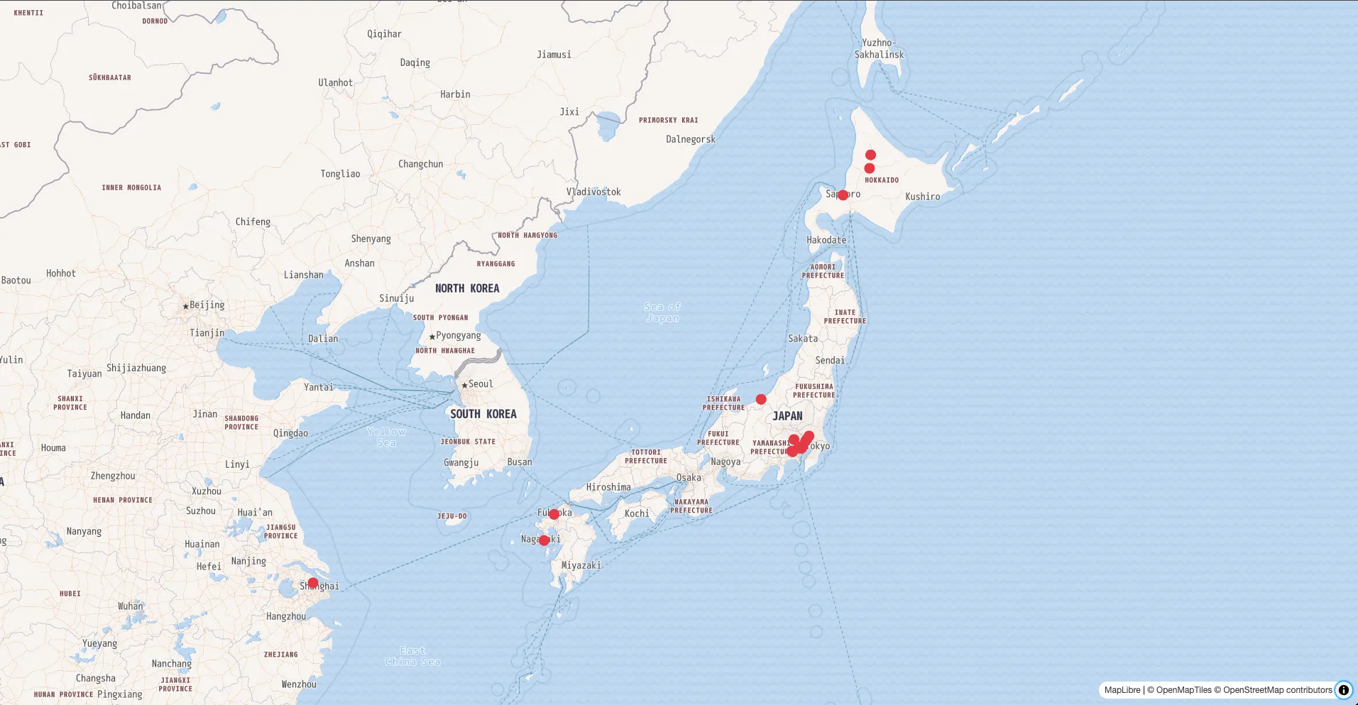
Result
Section titled “Result”The data retrieved from the CMS is displayed on the map.
For the full endpoint specification, see Public API Reference.