パブリックAPI でアイテムを GeoJSON 形式で取得して地図に表示する
更新日
パブリックAPI を使うと、ジオメトリフィールドを持つモデルのアイテムを GeoJSON 形式で取得できます。取得した GeoJSON はそのまま MapLibre GL JS・Leaflet などの地図ライブラリや、Re:Earth Visualizer に渡して表示できます。
サンプルコード
Section titled “サンプルコード”パブリックAPI からアイテムを GeoJSON 形式で取得して MapLibre GL JS で地図に表示する HTML のサンプルです。WORKSPACE_ID・PROJECT_ID・MODEL_ID は、実際の値に置き換えてください。
<!DOCTYPE html><html><head>  <meta charset="utf-8" />  <title>Re:Earth CMS パブリックAPI + MapLibre GL JS</title>  <link href="https://unpkg.com/maplibre-gl/dist/maplibre-gl.css" rel="stylesheet" />  <script src="https://unpkg.com/maplibre-gl/dist/maplibre-gl.js"></script>  <style>    body { margin: 0; }    #map { width: 100%; height: 100vh; }  </style></head><body>  <div id="map"></div>  <script>    const WORKSPACE_ID = "<workspace_id_or_alias>";    const PROJECT_ID = "<project_id_or_alias>";    const MODEL_ID = "<model_id_or_key>";
    const map = new maplibregl.Map({      container: "map",      style: "https://tile.openstreetmap.jp/styles/osm-bright-en/style.json",      center: [139.6917, 35.6895],      zoom: 10,    });
    const CMS_URL = `https://api.cms.reearth.io/api/p/${WORKSPACE_ID}/${PROJECT_ID}/${MODEL_ID}.geojson`;
    map.on("load", async () => {      const resp = await fetch(CMS_URL);      if (!resp.ok) throw new Error(`HTTP ${resp.status}`);      const geojson = await resp.json();
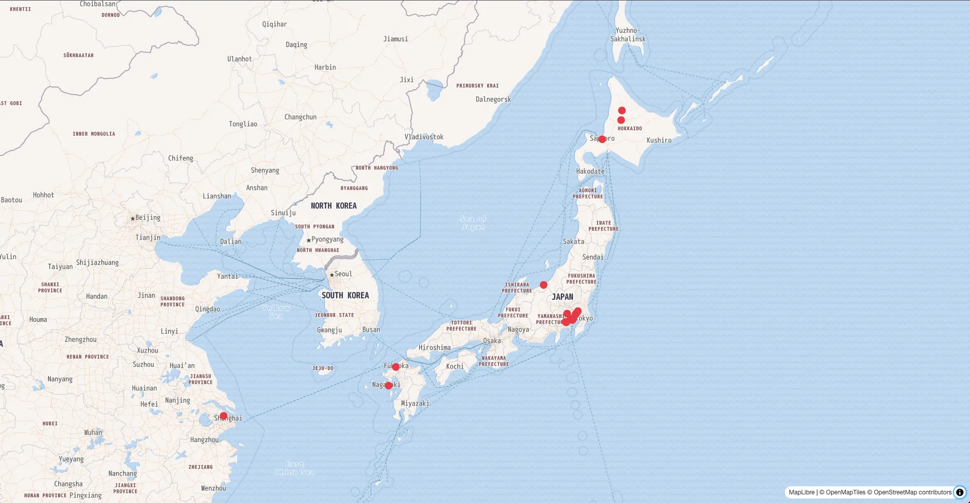
map.addSource("cms-data", { type: "geojson", data: geojson }); map.addLayer({ id: "cms-layer", type: "circle", source: "cms-data", paint: { "circle-radius": 8, "circle-color": "#e63946", }, }); }); </script></body></html>地図上に CMS から取得したデータが表示されます。
エンドポイントの詳細な仕様については、パブリックAPIリファレンス を参照してください。